- This event has passed.
August 2, 2023 @ 6:00 pm - 7:00 pm
Rivers Revealed—Uncovering the Hidden Pathways of Flowing Water with Lidar with Dan Coe

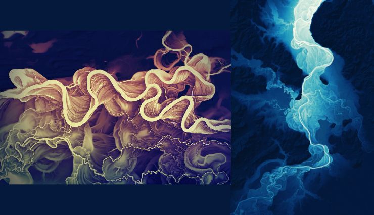
Lidar (light detection and ranging) is a technology that uses laser light pulses to create intricate three-dimensional models of the earth’s surface. These models can be used to create stunningly detailed images of rivers and floodplains. These depictions often reveal previously unseen channels where rivers have flowed in the past and invite viewers to visually meander along these pathways through both space and time.
When visitors enter The Community Library’s Wood River Museum of History and Culture, opening July 6, 2023 in Ketchum, they will be greeted with a lidar-derived representation of the Big Wood River, created by Coe. During this program, Coe will discuss the making of this image and will show several other lidar river images from the Pacific Northwest and around the world.
Daniel Coe has been making maps and visualizing spatial data in the Pacific Northwest for the past two decades. He lives in Olympia, Washington, where his work explores the geomorphic history and natural hazards of the region. Daniel’s award-winning cartographic designs have been featured in National Geographic, High Country News, and the Atlas of Design, among others. When not making maps, he is usually out exploring the forests and waters of Washington with his family. dancoecarto.com.
Registration recommended to save your seat.
Images: Murray River Channels (left) and Willamette River (right) by Daniel Coe.

